

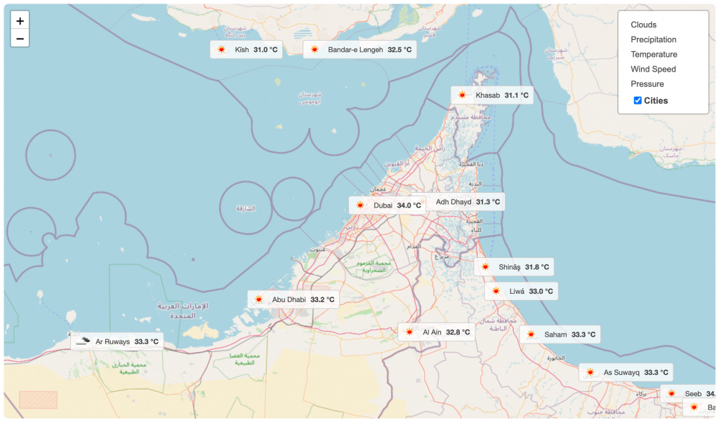
The Weather Map by OWM Block allows you to display an interactive map with live weather overlays, powered by OpenWeatherMap data. This block is ideal for visually representing weather conditions, such as clouds, precipitation, or temperature, directly on a map.
Here’s how to add it to your WordPress page or post and customize it to match your needs.
Weather Map by OWM – Key Features
- Interactive Weather Map: The block displays a fully interactive map, allowing users to zoom in, zoom out, and pan across different locations.
- Layered Data: It can display various weather data layers, such as temperature, clouds, or precipitation, directly on the map for a visual forecast.
- Powered by OpenWeatherMap (OWM): The weather data for the map is provided by OpenWeatherMap, ensuring accurate and up-to-date information.
- Dynamic Visuals: The block uses animated weather data to show real-time changes in conditions like clouds and rain.
Using the Weather Map by OWM
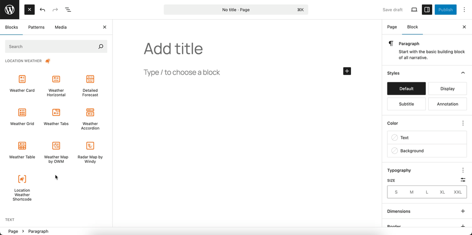
- Go to any WordPress page or post you’re editing.
- Click the ‘+’ button to add a new block.
- Search for “Weather Map by OWM” or find it under “LOCATION WEATHER.”
- Click it to add it to your page.
You can instantly see the live Preview of your customization. Once you’re happy with the design, click Publish or Update.
Let us explore the Weather Map by OWM Block
Set Location Settings
This section allows you to define the geographic location for which the weather information will be displayed.

- Enter Geo Coordinates: Use this field to insert the latitude and longitude of a specific location. You can find the coordinates for any place by using the provided “Get coordinates” link.
- Custom Location Name: Enter a custom name for the location you’ve selected. This name will be used to label the weather information on the front end of your site.
- Auto Detect Visitor’s Location: When enabled, this feature automatically detects the geographic location of your website visitor and displays the weather forecast for their current location.
Measurement Units Settings
This section allows you to customize the units used to display weather data in the Location Weather block. You can choose the standard units that best suit your target audience and location. For more details, visit this link.
Weather Map Preferences
This block section is designed for configuring how weather information is displayed on a map. It allows you to customize the data source, visual style, and interactive behavior of the weather map. For more details, visit this link.
Control Layers
This block section is designed for controlling which weather data layers are available to be displayed on the map. It allows you to enable or disable specific weather data types and set a default layer. For more details, visit this link.
Popup Weather Data
This block section allows you to control which pieces of weather data are displayed in the popup when a user interacts with the map. You can customize the information shown for a specific location by enabling or disabling various data options. For more details, visit this link.
Advanced Settings
This section allows you to control the visibility of the block across different device types. You can choose to show or hide the block on desktops, tablets, or mobile devices to optimize the user experience for each screen size. For more details, visit this link.